In partnership with

With robust experience in landslide hazard management PRIS-NAT has the ambition to become a key contributor of population protection.
PRIS-NAT is a company turned to the future, our objective is to anticipate future changes and their impacts.
PRIS-NAT is at the cutting edge of innovation, anticipating and answering the issues of today and future.


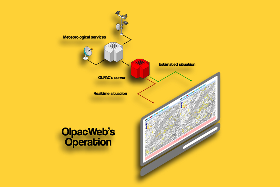
OLPAC Consult is an expert system that offers help in the decision making, based on climatic scenarios estimating instabilities and associated mudslides over time in the pre-selected area.
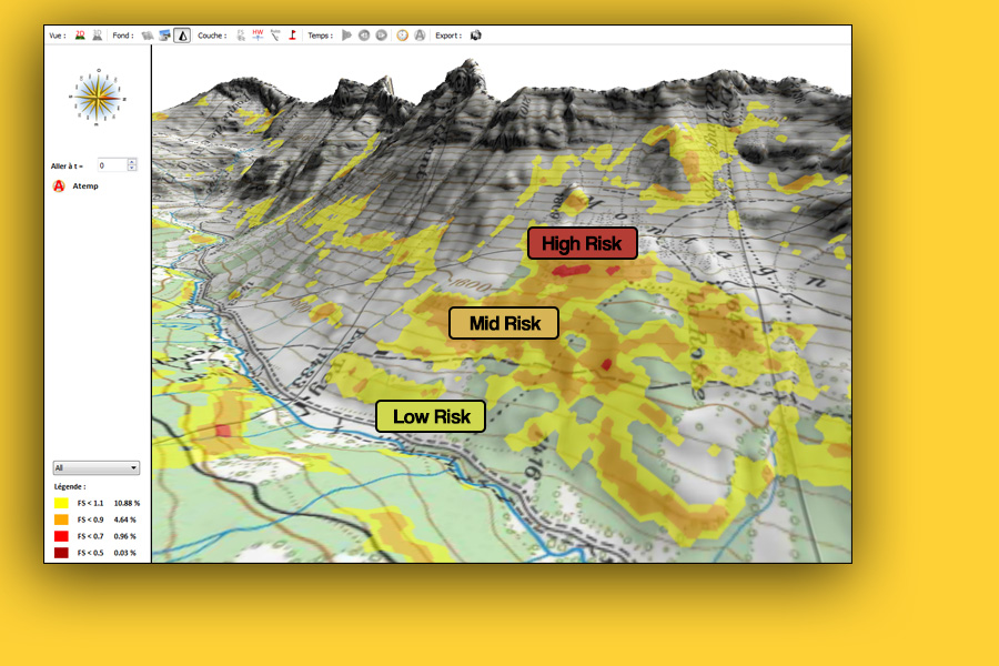
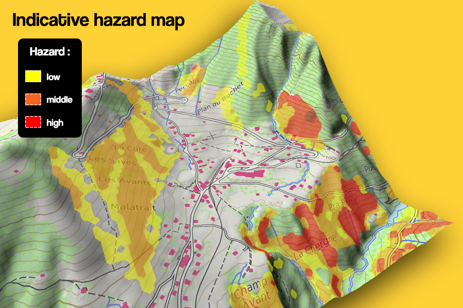
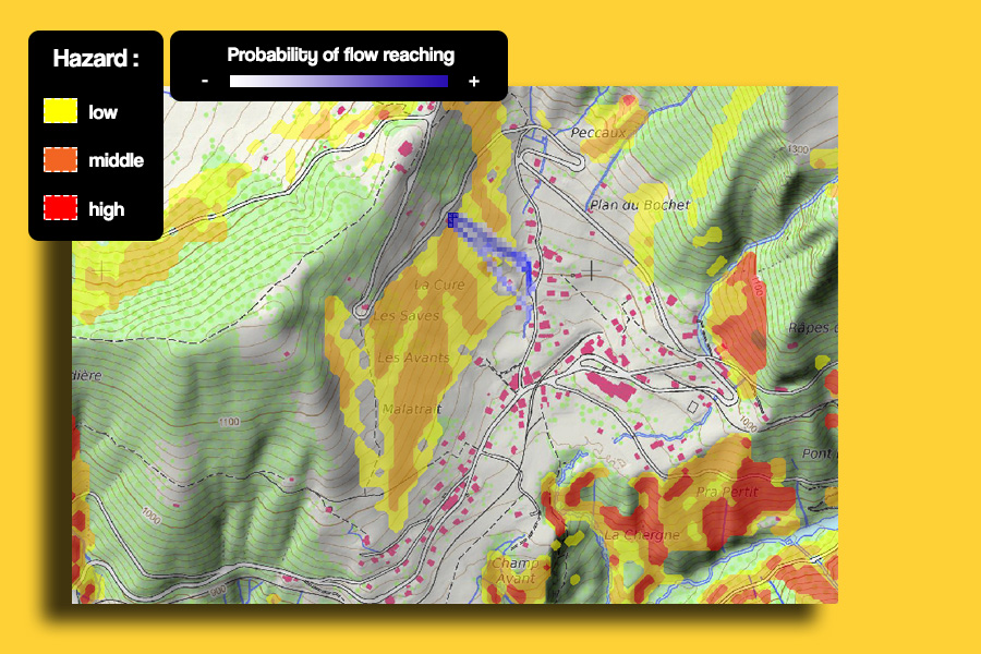
It generates indicative hazard maps required for territory management (construction permits, communication path, highway structures and more).
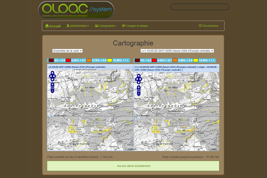
Olpac Web is a pre-alert system monitoring in real-time the evolution of soil stability related to precipitation. Improving sensitive area security is a direct application of OlpacWeb system (civil infrastructures, properties, engineering structures and more).
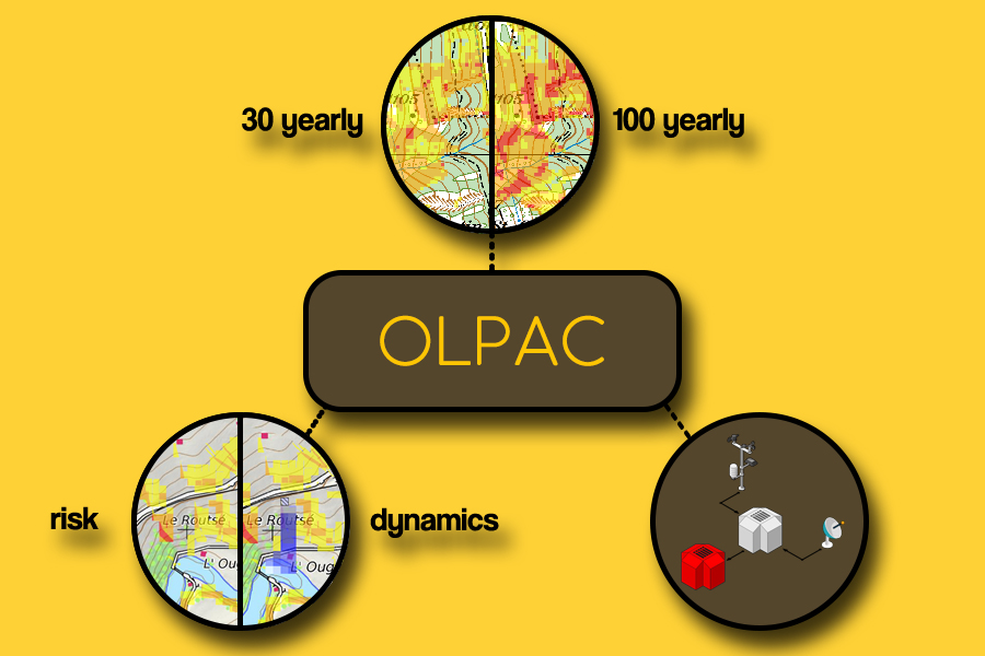
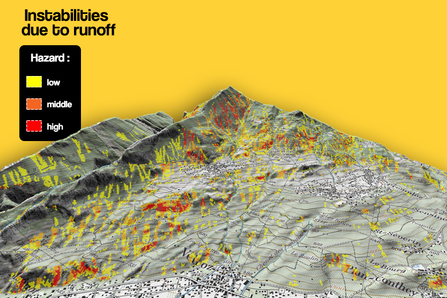
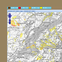
Landslides and associated mudslides indicative hazard maps.
Maps of the hazard evolution depending on climate change or deforestation.
Alert triggering service (territory, roads, highway structures, grid and more).
Area of Val d'Illiez since 2018.
Area of Sierre since 2020.
Canton of Vaud since 2022: Begnins, Les Avants, Lutry, Moudon, Ollon, Rougemont, Ste Croix, Vully, Les Diablerets.
The first version of OLPAC arises from research works of an Internation Program in Ecuador. The prototype took the form of a GIS script developed with the Research Institute for Development (RID).
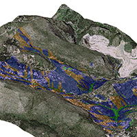
Thanks to research works and applications on concrete cases, the existing method has been enriched with new bases: integration of a semi-dynamical model for the calculation of hydrogeological balance in soil.

Beginning of a partnership with the FOEN (Swiss Federal Office for the Environment) and the Vaud Canton. Design of a new product: Olpac Consult.
Setting the first test site for the realtime monitoring in the Val d'Illiez (Switzerland) in partnership with the FOEN and the Valais Canton. Development of new algorithms for the management of the landslides flow, with the help of the FOEN Innovation services.

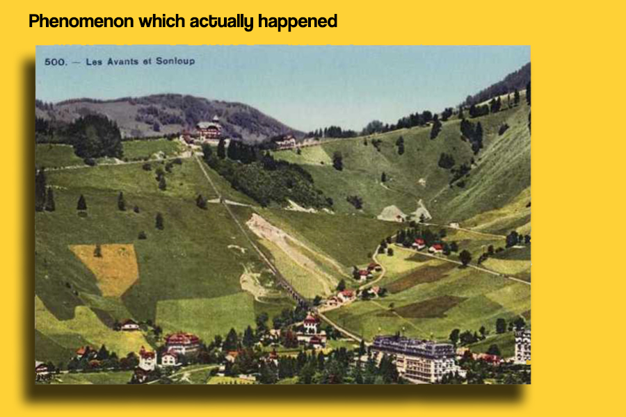
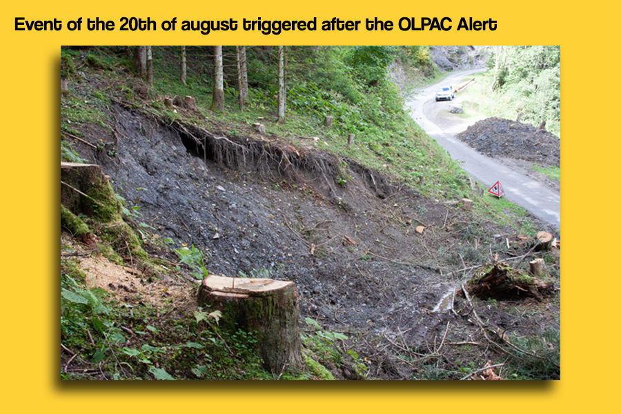
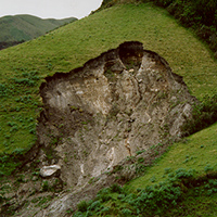
After two unfavourable meteorological conditions and the forecast of an import quantity of rain, OLPAC Web sent an alert. Multiple landslides occurred after the forecast date provided by the OLPAC alert.
OLPAC is deployed on 9 regions of the Canton of Vaud, marking a major milestone in the operational coverage of natural hazard monitoring in Switzerland.